WIP: GPS Mapping Chicago Trails — Part 3: Putting It All Together
This is part 3 in a series of blog posts where I am taking a deep dive into the world of GPS mapping. In this part of the series we're going to wrap everything up. I will have GPX files available for download and links to trails on Hiking Project.
- GPS Mapping Chicago Trails — Part 1: Schiller Woods
- GPS Mapping Chicago Trails — Part 2: Software
- GPS Mapping Chicago Trails — Part 3: Putting It All Together
⦾ Sorting out the Mess

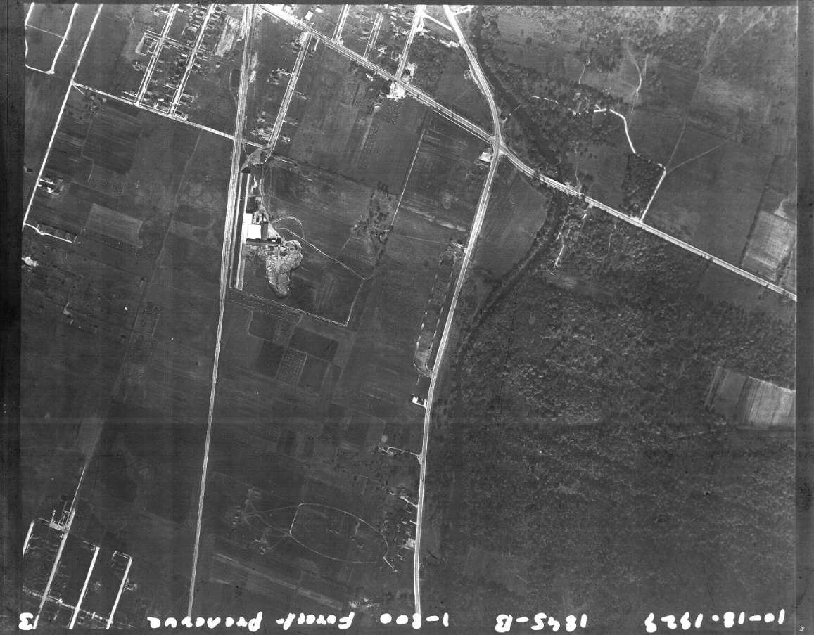
Chicago Aerial Photo Services, Des Plaines River Forest Preserve 1929 #1, Schiller Woods, CAPS_1929_8145_1.jpg, Chicago Aerial Photo Services Collection (University of Illinois at Chicago). CARLI Source Page
Schiller Woods is in the bottom right quadrant, bordered by Irving Park Road on the north and North River Road on the west.
What happened with all that GPS data and the messy trails? I talked with some friends about it and they suggested reaching out to someone official who can answer with authority about the situation. Primarily I needed to focus on answering the question "is there an intended route through this forest?"
I reached out to the people at the Forest Preserve of Cook County:
Hello, I would like to know if the trails in Schiller Woods South have names or identifiers, and if there are any intended routes.
Specifically region bordered on the North and South by Irving Park Road and the Indian Boundary Golf Course, and bordered on the East and West by N Cumberland Ave and the Des Plaines River.
I've noticed there are some markings on some trees but they are inconsistent and do not cover any of the paths entirely.
There seems to be a blue and yellow bullseye around a triangular path sequence in the middle. And there are red arrows going kind of mostly east and east.
Do these have names, or is there any intended route? I ask because I want to do some GPS recordings and upload them online, but because the paths aren't very clear there's no obvious way to name or label anything.
Thanks so much!
A few days later I received a brief response which did not directly answer any of my questions.
Hi Tim,
Thank you for reaching out to the Forest Preserves of Cook County.
Typically, we do not name trails (one exception would be at our nature centers) but instead use colors to differentiate between trail segments within a larger named trail system. Any official trail signage on the ground (intersection posts, confidence markers, etc.) should include corresponding colors to match the official trails we publish on our maps, webmap and website:
https://fpdcc.com/places/trails/des-plaines-river-trail-system/
I wasn't satisfied with this response so I probed further.
- Does all this mean that the trails in Schiller Woods South aren't official then?
- Do you have any official records or documentation of the myriad trails down there?
- These trails do exist, but just aren't documented. What does that mean about their protected or maintenance status?
Thank you so much for your time! I enjoy these woods and I appreciate your earlier response.
After a few days went by I bumped the email thread and this time I received a much more complete response. The answers were not the ones I had hoped to receive.
Correct. The trails in the southern region are not official Forest Preserves trails, but rather, unmarked trails on our website and web map. Here's some more information regarding unofficial trails that may be of interest:
In addition to designated paved, graded, and primitive/rustic trails, there are many non-designated trails throughout the Forest Preserves. Such non-designated trails may occur naturally as deer trails or through human foot traffic over time. The Forest Preserves does not encourage, but generally does not prohibit, the use of non-designated trails. Users of such trails, however, should note that the Forest Preserves does not inspect or maintain non-designated trails. Accordingly, hidden and latent dangers, as well as other hazardous conditions, may be encountered on non-designated trails. Users of non-designated trails do so at their own risk and are encouraged to minimize their use of such trails. (Source: https://fpdcc.com/about/rules-regulations/trail-risk-statement/)
I enjoy this next part. It seems that the staff are unsure about those pretty crap blazes I observed before:
As for the markers you've encountered, and upon reviewing internally with staff, it has been relayed that these likely are not official markers—and may be the work of local cub scouts or other groups. If possible, please forward along any photo references you may have for Forest Preserves staff to confirm, or if you don't have any on-hand, we can ask that our staff take a look and confirm on that end.
In a followup response I provided a gallery of about 50 photos I took of all the "not official markers" for their review.
The response continues:
In conclusion, the only official trail running through this area is the yellow unpaved trail (part of the Des Plaines River Trail System) running north to south from Irving Park Road to Belmont Ave. Any other trails in this area would be considered unrecognized, unofficial trails. These trails were likely formed without Forest Preserves’ consent and are not published on our maps because they present a variety of issues (unmaintained, may occur in ecologically sensitive areas that cause damage to the environment, etc.). Forest Preserves visitors are encouraged to only use our official trails.
There you have it. Those trails are unofficial. Their use is discouraged, but not prohibited.
⦾ But what about...?
I'm glad you asked. Because I'm curious about that too.
The response I got quoted a policy on their website (snippet…):
Users of such trails, however, should note that the Forest Preserves does not inspect or maintain non-designated trails.
There is an actual bridge crossing over Schiller Brook, and people cross over this bridge every day. Certainly there must be some kind of inspection happening regularly to ensure the public safety. Is that maintenance?
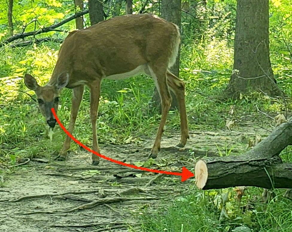
Did you notice that little detail in the first deer photo I posted? You know the detail I'm talking about, right? It's subtle, but it speaks volumes. I'm talking about this detail:

A tree (or more likely, a large branch) fell there recently. There are still leaves drying up on it (visible in the full photo shown earlier). And the fallen branch has been cut by a human tool. The rest of the debris has been removed from the trail.
I mentioned earlier that the data in OpenStreetMaps is associated with change sets that are 14 years old. I'm sure before the Japanese Barberry moved in this forest was much clearer and easier to navigate. And certainly there has been considerable undergrowth in the decade+ since that data was acquired and documented.
Perhaps these paths were obvious shortcuts and bypasses to the "unpaved yellow trail" (the "Des Plaines River Trail"). It would explain a lot about their haphazard routes.
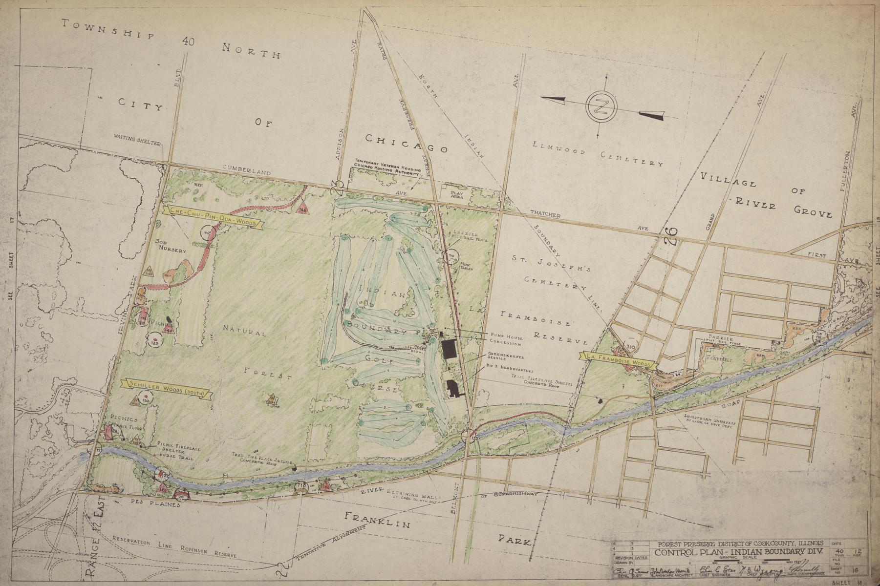
 Source: Forest Preserve District of Cook County Records, University of Illinois at Chicago Library - FPDCC_06_01_0000_0015_015 - Indian Boundary, Des Plaines River
This post is still incomplete. Sorry.
Todo:
- Detail final email exchange about guerilla trail maintenance
Need to copy paste for this
- Detail before and after of big post-storm cleanup
Need to collect and name and crop photos
- Reveal conclusion: the flood bypass theory
Need to write it up and generate some photos