GPS Mapping Chicago Trails — Part 2: Software
⦾ Intro
This is part 2 in a series of blog posts where I am taking a deep dive into the world of GPS trail mapping. In this part of the series we're going into the software I've been playing with to view and process the captured GPS data.
- GPS Mapping Chicago Trails — Part 1: Schiller Woods
- GPS Mapping Chicago Trails — Part 2: Software
- GPS Mapping Chicago Trails — Part 3: Putting It All Together
⦾ Getting Started
Part of my motivation for starting this project was the lack of available information of what was out there to walk in Schiller Woods South. Google maps didn't have anything listed, and some of the trails got kinda sketchy. You could be pretty sure that people were walking there before, but if you went much farther it could become less clear where to go next.
This is what prompted my search for trail recording software. If I couldn't find existing trail maps, then I would make my own.
My mobile device is a Samsung Galaxy S22 Ultra running stock Android 14. I like this device quite a bit. What I like most of all about it is the super crisp display and the excellent photos the camera captures. This is what I used to record the trail GPS data. Yeah, the GPS hardware in it isn't professional grade, but I didn't need that to go out and have some fun.
But to be clear, I did attempt to make an impulse purchase that weekend for a proper GPS recording device and got blocked by the lack of options I could actually drive to. REI and Best Buy near me were only carrying fitness devices with basic GPS viewing functionality.
I didn't need anything fancy as far as software goes, my requirements were quite modest:
- Record GPS data in some portable format
- View GPS data over a map
- Optional: annotate data with pins
Unsurprisingly it turns out that most software in the app stores are loaded with ads and pushy in-app purchases. This post is not about those apps. I avoided those apps. This post is about these nice apps that I enjoyed using.
⦾ TrekMe
The first app I installed is called TrekMe - GPS trekking offline. It does not annoy me to use it. As in, there are no ads, or constant begging to upgrade to the paid experience. It satisfies all of the requirements I outlined above. The paid upgrades are for higher resolution map data which I didn't need. I like this app and I still use it.
Fun fact: if the author's name, Pierre Laurence, didn't give it away already, you can tell this app was made by a french person because of the prefix unit it uses when showing you how large the map data download will be.
I learned this many years ago on my python "bitmath" project when a user submitted an RFE on github requesting support for parsing french unit names. I guess over there they say octets in speech instead of bytes. Neat!
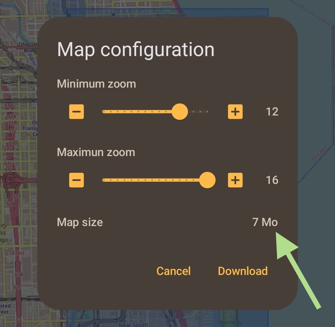
This post isn't about in-depth app reviews. So, in brief, TrekMe records GPS data in a standard file format that I could easily export. The user experience is a little clunky, but it works and is not obtrusive. And it's free. I like that. There are screenshots on the google play store if you want to see more.
TrekMe is also how I found out about the known and already mapped trails in SWS. I discovered this when I was creating a new recording one day and selected a different source for the map data. Previously I used the U.S. Geological Survey, this next time I tried the OpenStreetMap data.
⦾ What is this Recording Data Anyway?
What format is a GPS recording? It's XML. But it's ok, hear me out. It's OK because it's actually standardized and big companies stick to the standard which makes the data very portable. But, best of all, there is an actual XML schema published that you can stick into your editor and use for real-time validation.
Wait what? Stick into your editor? I thought the device made the recording file? Yes, that is true. My device did do all of the recording for me. But I'm a geek who had to keep looking behind the curtain to understand the next layer of technology.
The XML format for GPS data is called GPX, the GPS Exchange Format. The current schema version is GPX 1.1. It is free and open and I love that. You could look at the XSD schema right now if you want to. But they didn't stop there, they actually published useful documentation. Coming from a person who has written thousands of pages of documentation, this is a big compliment.
Here's a simple truncated example of a fully formed document with two track points I recorded myself:
<?xml version="1.0" encoding="utf-8"?>
<gpx version="1.1" xmlns:xsi="http://www.w3.org/2001/XMLSchema-instance"
        xmlns="http://www.topografix.com/GPX/1/1"
        xsi:schemaLocation="http://www.topografix.com/GPX/1/1 http://www.topografix.com/GPX/1/1/gpx.xsd"
        creator="TrekMe">
    <metadata>
        <name>combo</name>
        <time>2024-06-16T09:10:30</time>
    </metadata>
    <trk>
        <name>redloop</name>
        <trkseg>
            <trkpt lat="41.9508266" lon="-87.8457736">
                <ele>157.9826350599507</ele>
                <time>2024-06-13T23:18:12</time>
            </trkpt>
            <trkpt lat="41.9508045" lon="-87.8457403">
                <ele>158.78511764077382</ele>
                <time>2024-06-13T23:18:15</time>
            </trkpt>
        </trkseg>
    </trk>
</gpx>
OK, you can use it in your editor if you're a lunatic like me. But more likely you would use the schema in an application that is dealing with GPX data and wants to ensure that every recording it produces (or is ingesting) is a compliant and valid file.
While we're talking about it, I want to mention that I also installed the VS Code "XML" plugin, which coincidentally was made by my former employer, Red Hat. I did not expect that.
The plugin worked for me. It identified the schema in the GPX document and validated the file automatically. When I was shifting tracks and segments around manually it was correctly pointing out invalid syntax errors and giving valid element and attribute suggestions. Well done.
⦾ Avenue GPX Viewer
I wanted a GPX viewer on my computer as well. For a few hours while walking the trails I considered how I would write my own shitty browser-based track viewer. Eventually I came to my senses and settled on finding an actual application that was already written.
At the time of writing I am rocking a stately 2022 M2 MacBook Air, running macOS 14.5 (Sonoma). Again, my requirements, were modest:
- Load GPS recording
- Overlay recording on a map
I think this search was easier than finding TrekMe on my phone. Pretty quickly I found Avenue in the App Store, saw that it was simple, free, and open source, so I installed it.
There's not much to say about it, so let me show you instead:
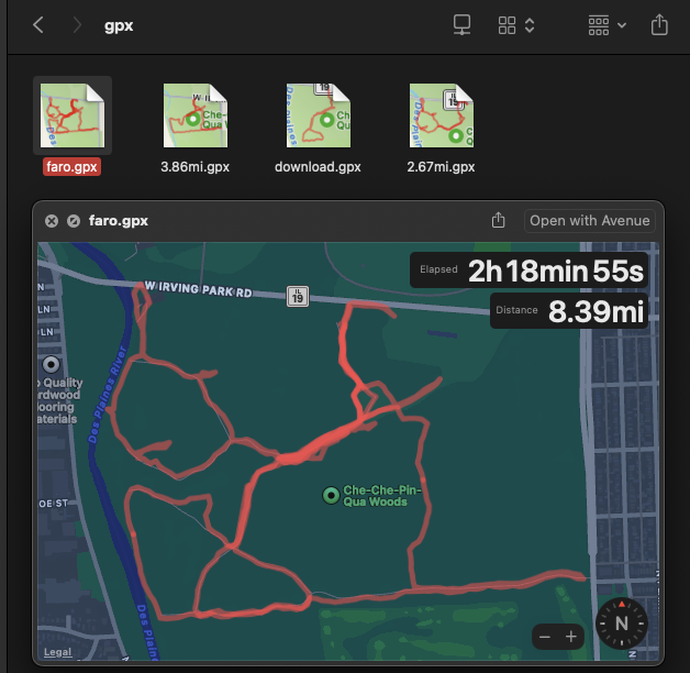
Above you can see that Avenue is capable of making the GPX file icons a preview
of their routes, and the [spacebar] preview menu function works as well.
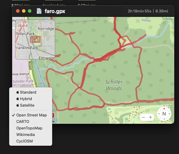
Above I have Avenue open with one of my recordings. There are actually several different track segments in the file I opened. It is correctly displaying them all at once. You can also see the minimap preview and the map source selector.
I noticed while writing this post that the author of Avenue actually contributed to another project, Open GPX Tracker, which is also free and open source, and has no ads or in-app purchases. If I had an iPhone I would try this for recording my data.
Thank you Vincent Neo! Avenue is great. I absolutely recommend it.
⦾ GPS Logger
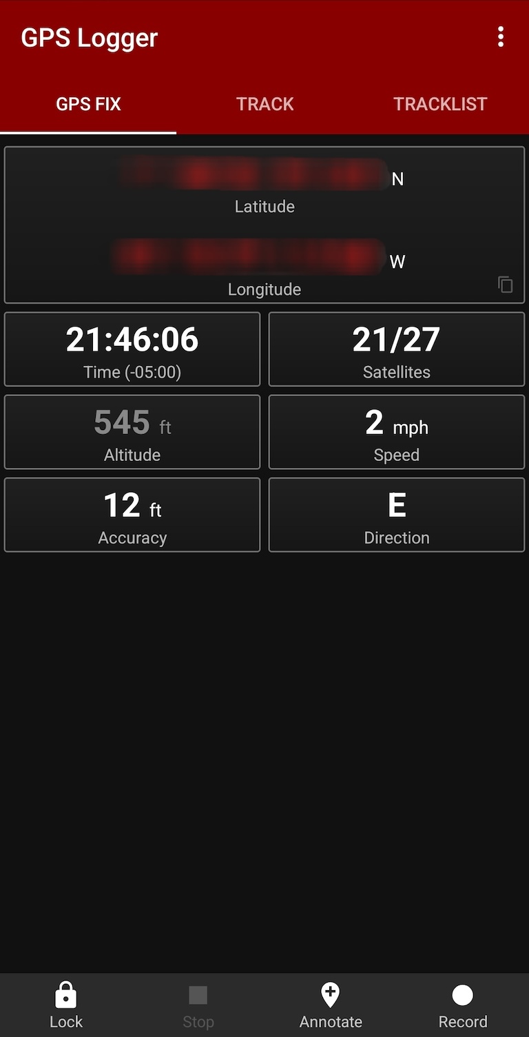
GPS Logger is another android app that I used. I think I saw a reference to it on an ATV forum. It is quite different from how TrekMe works. It does not include any maps, it is pure data acquisition.
It allows you to adjust the capture frequency slightly and allows you to export in plain text, GPX, and KML (keyhole markup language) formats. It also includes altitude correction features. There are no ads and there are no in-app purchases.
I like GPS Logger. It does one thing and it does it very well. In particular I like that the main recording screen contains all of its buttons in a single row and you can lock out that row from accidental pushes while you're recording. The data display is quite useful.
⦾ Hiking Project
I mentioned earlier that I tried Hiking Project. To be completely honest, it's kind of annoying to use. It felt difficult to locate, select, and do anything useful with tracks.
It did let me record my own tracks. But it wants to integrate with the online service when I just wanted to record something for myself. Maybe I was doing something wrong.
It didn't help my experience when The Forest Preserve group had multiple trails and spurs entered with the same name, so when Hiking Project asked me which trail I was on I had 3 choices with the same name and no context to indicate which forest they're in.
⦾ gpx studio
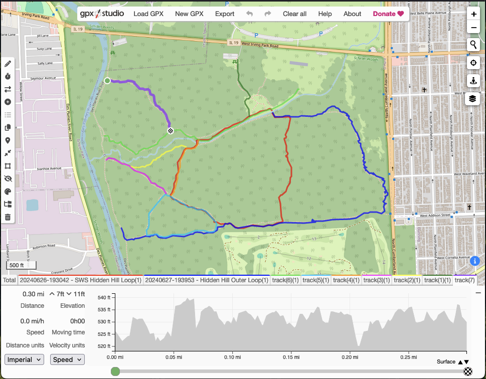
Allow me to introduce you to gpx studio. When I found this I was immediately confident that my earlier decision to not write my own browser-based viewer was the correct choice.
This tool kicks ass. And it's free! AND It's open source! I could fill up another page here writing out everything it does, so instead I'll strongly urge you to go to the project's about page and look at the list yourself.
⦾ Putting it all Together
At this point I have accumulated close to 40 miles walking those trails. Each trip out there I improved my collection method and refined my routes. I learned more about the forest and slowly developed an idea of what's missing. I also began to suspect that something was not quite right.
What do I mean by "not quite right"? After talking with some friends for a while we noticed that there are no clear and obvious "main trails". In other words, there are no indicated begin and end points. This is an issue.
Let's step backwards a bit, I'm going to introduce some language from the GPX specification because the specification captures the way that people commonly conceptualize trails. It also codifies how we must handle trails in our software.
<trkseg>- A Track Segment holds a list of Track Points which are logically connected in order<trk>- Represents a track - an ordered list of points describing a path
A <trk>, track, is "the trail" you're hiking. For a simple out and back trail
(types of trails) you
just have one <trkseg> in your <trk>. The track segment contains all of
the points from the starting location to the ending location. These points are
in order.
Now let's say that there are little trails shooting off of the sides of your out
and back trail. Each of these offshoots would be another <trkseg> that starts
at a point on the main <trkseg>. Logically they are connected in some way to
the main trail you are on. Sometimes these are called "spurs".
You might also have connectors which connect two main trails together. The connector segment only exists because the other main segments exist.
A good trail will typically have trail indicators posted. Sometimes they're symbols on trees (these are called blazes), sometimes they're piles of stones (cairns), or maybe just posts in the ground.
I spent two days with a clipboard and a pen, walking every single trail again trying to find the signal in the noise.
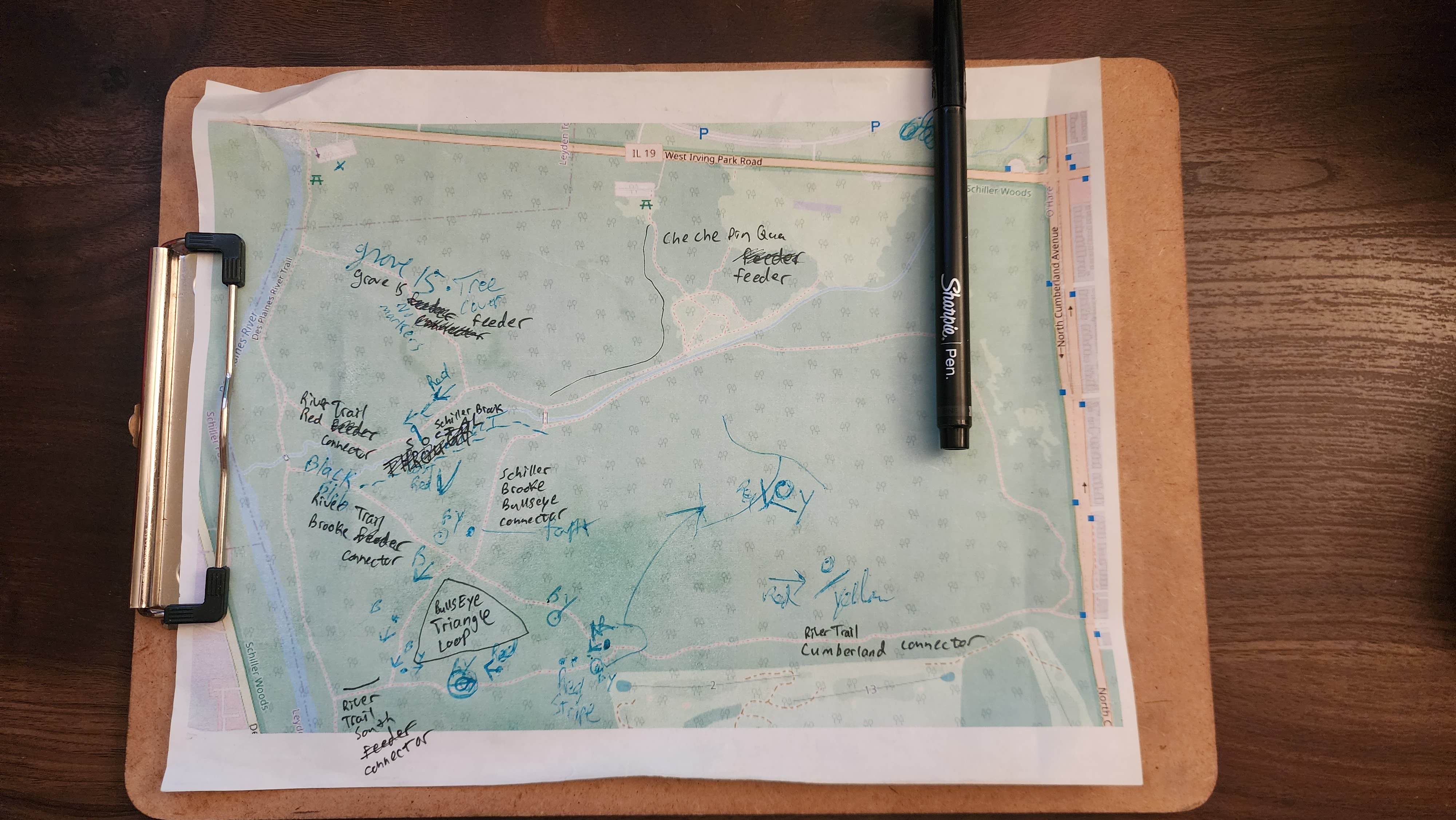
I examined every blaze. I noted their patterns and locations.
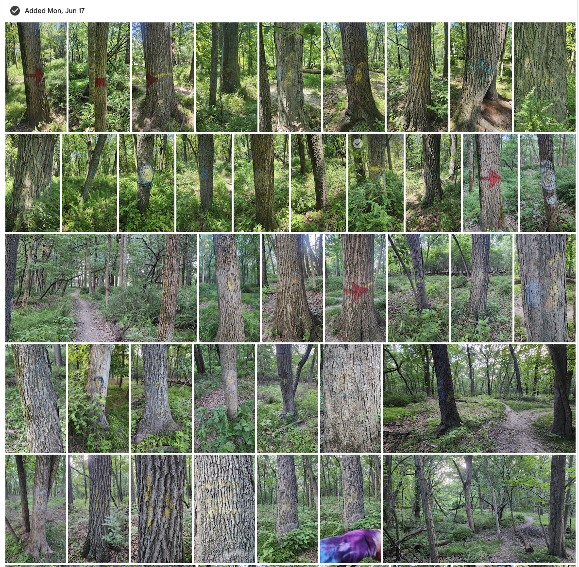
I was not making any progress.
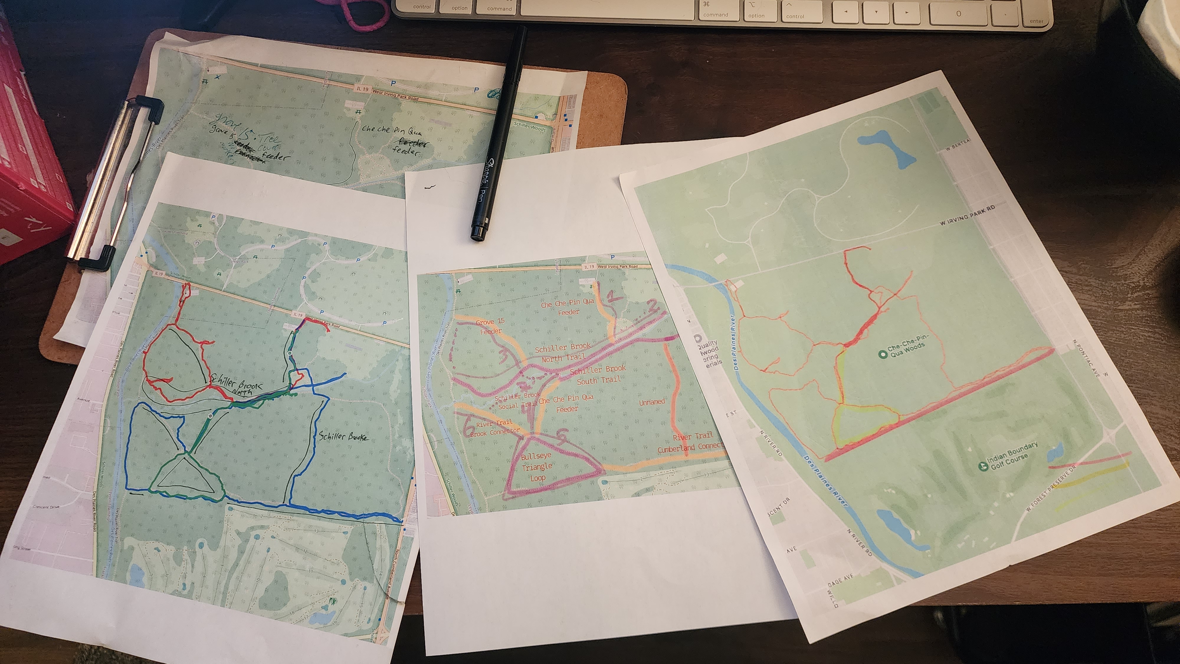
I asked a friend for advice about the blazes.
"I don't know. Those are pretty crap" - my friend
He was right. They are pretty crap.
Schiller Woods South has nothing consistent or complete.
It is absolute chaos.
It is unfocused.
It is crisscrossing lunacy.
Let's take a break. Let's talk about something nice for a minute. Like getting thorns in your hands, and invasive species.
⦾ Japanese Barberry
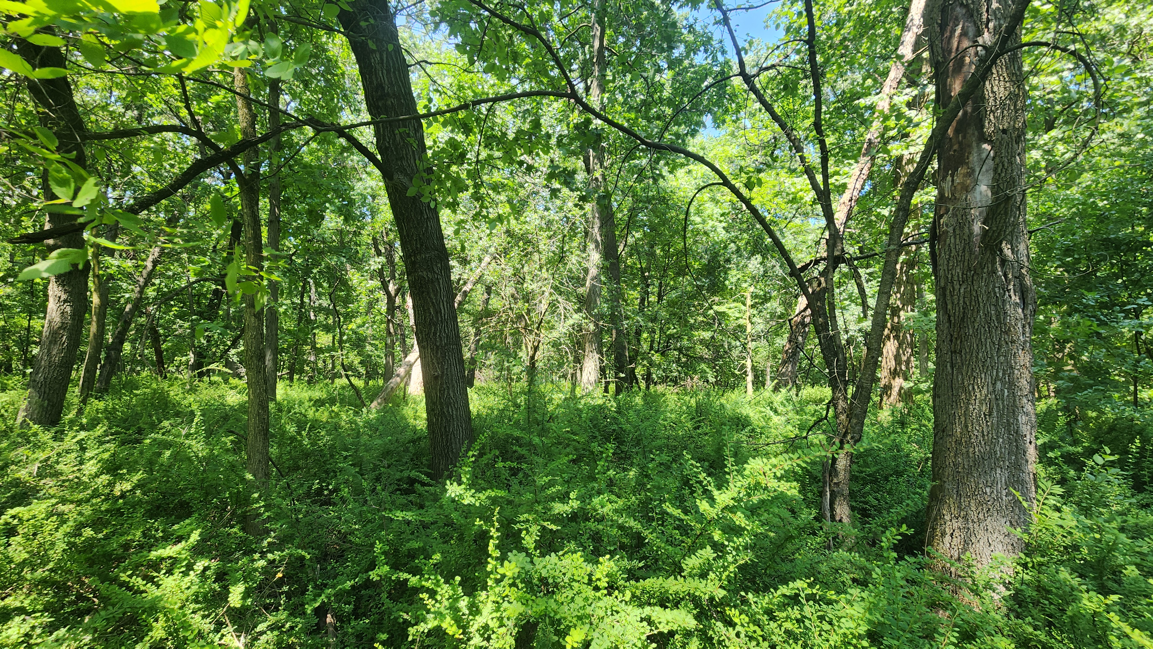
"The dense stands of Japanese barberry effectively become a monoculture, replacing the diverse, native understory with one species. Japanese barberry invasion reduces the carrying capacity of wooded pasture and limits the movement of livestock. Cattle and other large animals cannot move through the thorny thickets."
Yeah. It sucks. And Schiller Woods South is getting overran with the stuff. In
the photo above we have an example of its invasive spread. I am 6 feet tall and
some of those plants come up to my shoulders. The floor of the forest is no
longer visible. The root of each barberry becomes a hive of scum and
villainy ticks.
The barberry creates an interconnected underground network of rhizomes – horizontal underground plant stems capable of growing another plant. That's right, it's like a hydra. You cut off one head and more come to replace it.
Also, those fuckers are covered in thorns 🖕🏻 (technically they're covered in spines).
It's not all bad though:
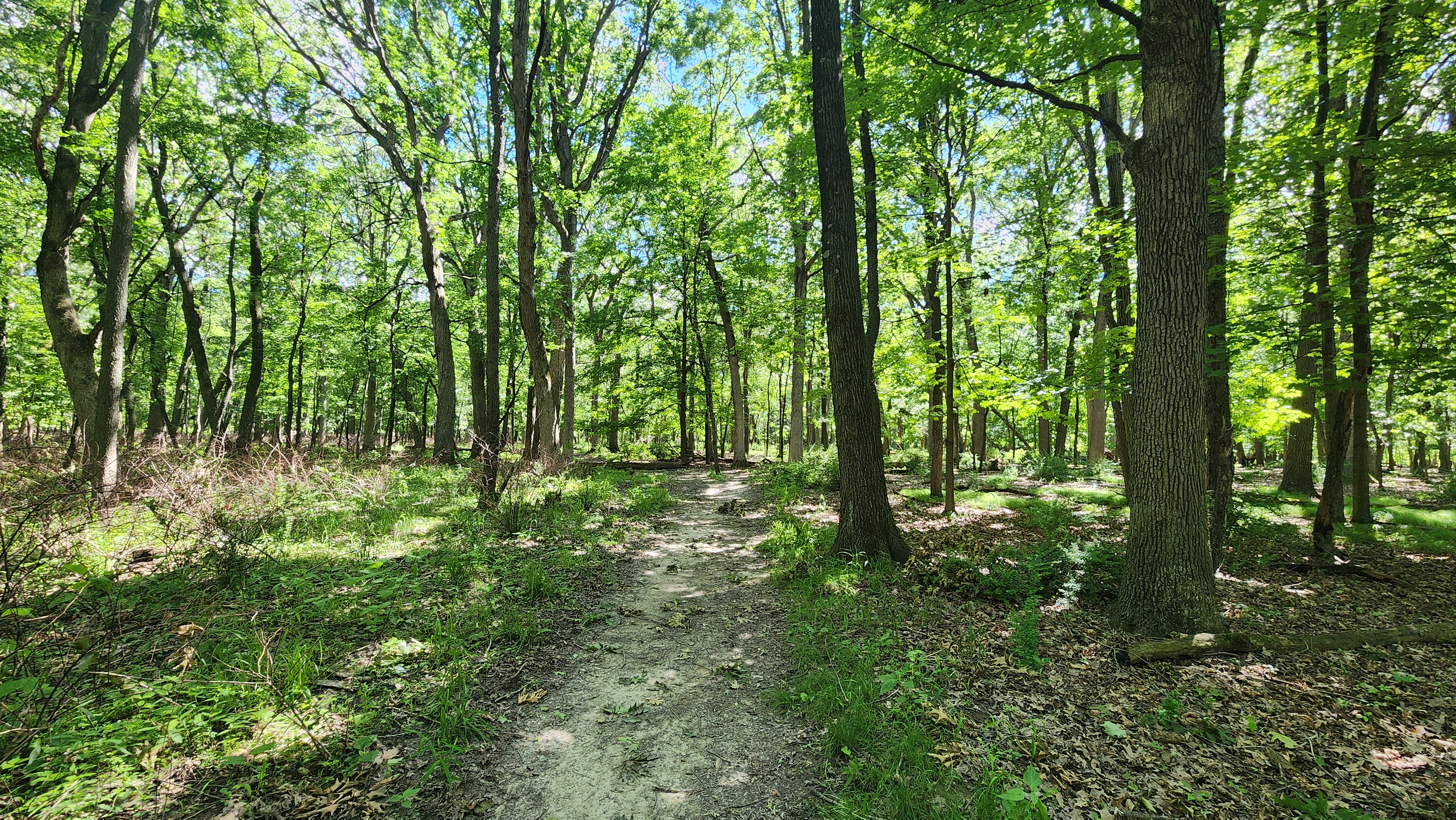
Much of the center area on the south side of Schiller Brooke, directly opposite of Hidden Hill is still gorgeous. if you